

To display the site correctly, please, enable JavaScript.
Chapter 7. Geoglyphs and modern fields
| << Previous | Contents | Next >> |
Now in order to get rid of the last doubts concerning the purpose of geoglyphs let us look at their connection with some functioning or recently abandoned fields. Such places are quite numerous. We came across one of them in the first route (Figure 1): lines-ditches if there was water would irrigate modern fields prepared for planting. Besides, the band of these fields went along the line the junction of small valleys containing geoglyphs with the main valley.
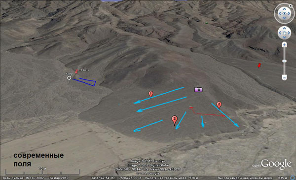
Figure 1. Blue arrows indicate the direction of the channels on this small terrace. In the lower left corner of the picture the band of modern fields begins, some of which retained even dry cotton bushes. The first point of the route is marked with a camera sigh. This is where the photo was taken.
Even more revealing is the proximity of the areas with many geoglyphs to the largest and most prosperous agriculturally territories. This tendency is most evident near the town of Palpa, Estudiantes villages, and the town of Nazca.
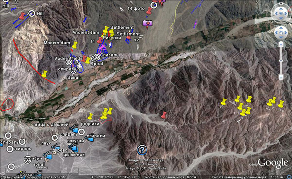
Figure 2. Accumulation of geoglyphs ear the oasis at the outlet of the Ingenio valley.
Figure 2 shows the “oasis” where the valley of the Ingenio river widens, near the Estudiantes villages. It is surrounded by the places with the greatest concentration of geoglyphs. The main one is the northern tip of the desert of Nazca (lower left corner of the picture). The next one in importance is the right bank of the Ingenio. Finally, it is the left tributary valley, in the lower reaches of which a lot of lines are. In its upper reaches there is a group of bands and wedges (yellow marks on the right).
The latter ones are of special interest because they are 500 m higher than the valley, and it would take lots of effort to reach them now. However, when the lines were being made these mountains were significantly lower, but this place never was a plain like Nazca. It was drained earlier. In my opinion, the ancient people made fields here because there was unconsolidated sediments cover on these tops and springs continued to function moistening the soil. There are many traces of these springs in the form of white spots and the lines are confined to them. On darker mountains to the north there is almost no loose cover, they are more rocky and it is more difficult to plant anything there.
Especially indicative is the tendency of the location of modern or recently abandoned fields directly within the bands or wedges (Figures 3, 4, 5).
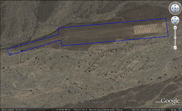
Figure 3. Modern fields on the wedges. The direction of the modern flow is from right to left (North is shifted!).
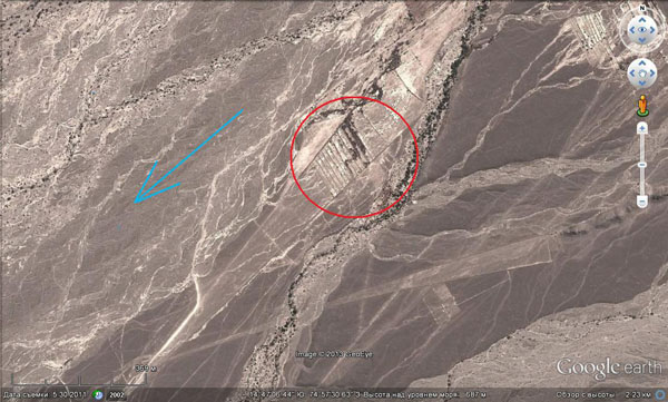
Figure 4. Fields on wedges (in a red circle).The direction of the modern flow is marked with a blue arrow.
As one can see in these pictures wedges are divided into plots of land. It was probably hard to find territory that was better cleared from stones. The plots shown in Figure 4 are supplied with water that does not flow from the southwest, as it used to flow before. It flows from the northeast according to the different territory sloping that rotated by 180 degrees. Therefore, new plots are not located in the acute angle, that used to be the most productive, but at the base of the wedge. These plots are supplied, most likely, by means of wells.
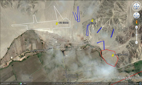
Figure 5. An old field is marked with a white contour. A red one marks the ancient settlement of the post-reconstruction era, when the rivers and streams appeared.
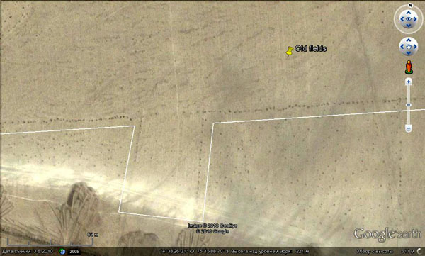
Figure 6. Dark points present stones collected in heaps.
Figure 5 shows old fields in the floodplain a little below the place of the confluence of the Nazca and Rio Grande rivers. The form of these fields is a combination of wedges and a rectangle. Now there is not enough water in them and they are abandoned. But in the lower parts of the floodplain there are still some functioning fields, and they have usual rectangular shape, while at higher levels classic wedge-formed geoglyphs remained. This is a good example of the evolution caused by changing conditions.
At higher magnification (Figure 6) you can see the remains of the rows of plants and heaps of stones on this field. I think that when looking at them no one will doubt that they are genetic relatives of lines and wedges that we had previously considered.
We have repeatedly seen that people in antiquity left some stones collected in this way on some wedges and bands, probably, hoping to remove them afterwards (Figure 7).
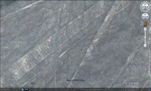
Figure 7. Stones collected in heaps on the ancient wedges.
Similar fields representing complex contoured areas were preserved along dry valleys near Cahuachi (Figure 8). Connection with the traditions is seen here as well − direct borders had the priority. At the curvings they break, not turn, and again at such places there are barrels or piles of stones.
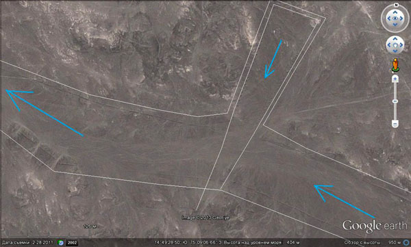
Figure 8. Fields in the valleys. Their contour is marked with a white line. Blue arrows show the direction of water flow.
The principal difference between them and the classical geometric geoglyphs is their confinement not to elevations or watersheds, but to the thalwegs of the valleys. This could be when in the process of reorganization of the relief the Nazca plain began to experience the shortage of water. Then valleys, because they had better water supply, became the most favorable place to grow plants. But the traditions of the designing of fields were the same and became evident in all kinds of details.
When after the reorganization of the relief Nazca started turning into a desert, all agriculture moved to the valleys of large rivers.
Figure 9 shows how one of the oldest settlements located at the mouth of a small stream looks. Nowadays the stream is dry.
Here you can see a lots of rectangular plots of various sizes framed with barrels. You can also see the traces of buildings. Above them one can notice a dam, that once blocked the valley, but later it was broken by the floods of water.
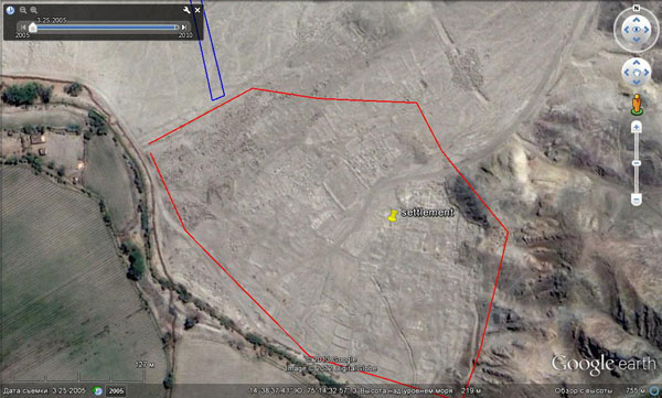
Figure 9. Old settlement in the floodplain near the confluence of the Rio Grande and Nazca rivers. Enlarged fragment of Figure 5.
However, the ancient enhabitants of Nazca were busy not only with the creation of fields for planting. The presence of regulation presented below shows that they created plantations of trees and bushes.
Near Palpa, on one of the plateaus near the wedges and lines, there is a plot with holes arranged in a strict geometrical order (Figure 10).
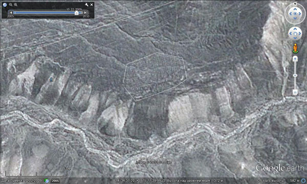
Figure 10. There is an ancient plantation of perennial plants at the center of the picture.
It is presented with better quality in the figure below (Figure 11) borrowed from an article written by Igor Alekseev and posted on the site The Laboratory of Alternative History “Geoglyphs of Nazca, some observations” (http://lah.ru/text/alekseev/nazka2.htm.). I advise all those interested in this topic to read this paper to achieve a more complete picture of the diversity of the Nazca lines and geoglyphs.
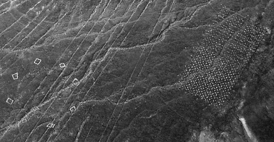
Figure 11. Traces of ancient plantations (on the right).
(http://lah.ru/text/alekseev/geo/ris156.jpg)
Most likely, these holes were initially filled with earth and had plants. They were irrigated as usual by means of surface channels. Following the restructuring and the formation of the plateaus, after the water dried up, the plantations were abandoned. The organic component of the earth that filled the hole eventually oxidized and disappeared. There is only mineral component left, and it is presented in the form of light carbonate.
Later traces of plantations can be found near the Ingenio Valley (Figure 12).
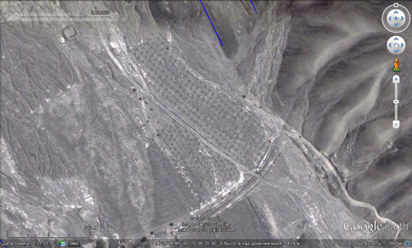
Figure 12. Right tributaries of the Ingenio valley.
Similar structured groups of holes can be also found in other places along the coast of Peru.
| << Previous | Contents | Next >> |


